Bus Service Improvement Plan (BSIP) - A690 Durham Road Scheme Overview


Background
The Bus Service Improvement Plan (BSIP) is a UK Government funded initiative to implement a wide range of significant proposed improvements to various aspects of bus services. These improvements will be delivered through the North East Enhanced Partnership, a formal partnership of the North East Combined Authority, bus operators, local authorities and Nexus.
The North East Combined Authority (NECA) has successfully secured £163.5 million funding from the Department for Transport by demonstrating the continuous commitment to improving and promoting alternative modes of sustainable transport.
This includes setting out ambitious targets to:
- Improve bus journey times
- ensure services run on time
- increase passenger satisfaction
- aspirations for all buses to be zero emission by 2030
For more information in detail please visit the BSIP website at www.buscentreofexcellence.org.uk/resources/bsips
The proposed route
The proposed bus improvement corridor will run from the A690 Durham Road/A19 junction and the A690 Durham Road / Barnes Gyratory. While two bus priority lanes were included as part of the original proposals, consultation feedback made it clear that these were not supported. As a result, we will not be implementing bus priority lanes.
Instead, we are focusing Bus Service Improvement Plan (BSIP) funding on the improvements that matter most to residents - enhancing road safety, improving accessibility to existing bus stops, and upgrading key transport infrastructure along both corridors.
Retained improvements - A690 Durham Road:
- Traffic signalised controlled pedestrian crossing outside Bede College Campus;
- Introduction of zebra crossing outside of Sunderland Children's Centre;
- Enhanced pedestrian access to all bus stops, including new carriageway and footway surfacing;
- Installation of modern bus shelters;
- Changes to junction layout into Springwell Road to help for right turning traffic;
- Upgraded paving at key junctions to improve accessibility for all users.
These revisions ensure that investment is focused where it is most needed and most welcomed. They also reflect our role as a listening council - committed to transparency, accountability, and putting Sunderland's residents first.
Image gallery (click to enlarge)
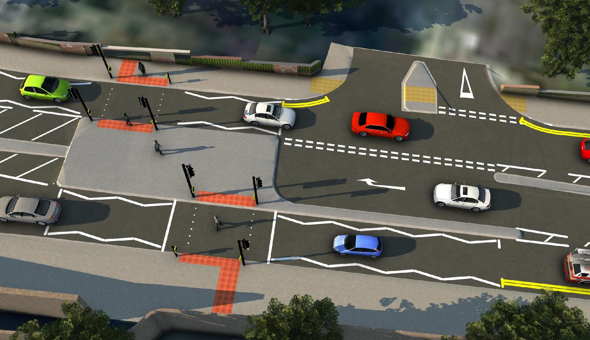
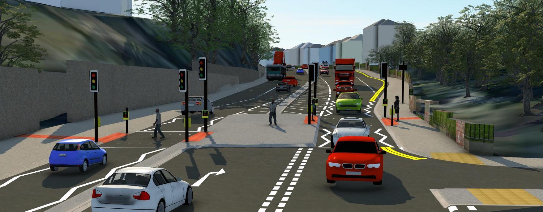
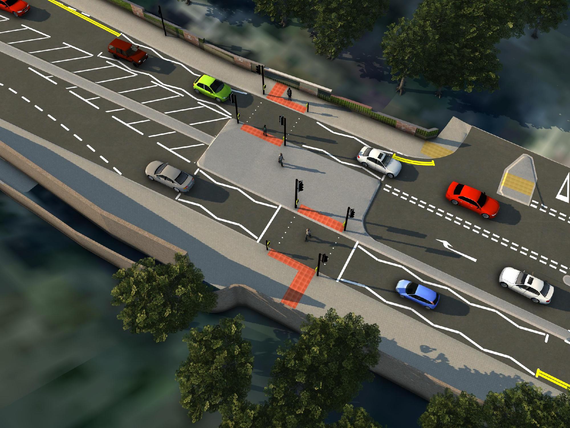
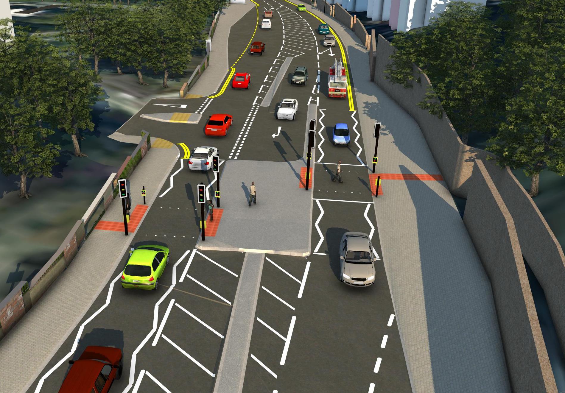
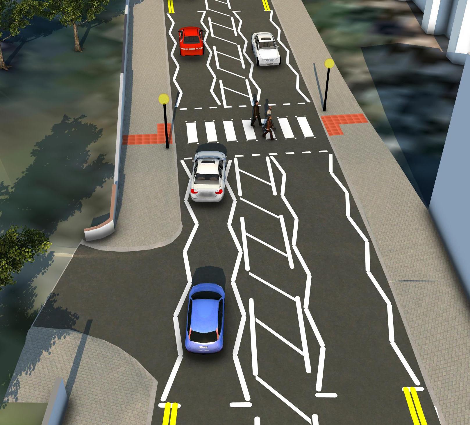
Image gallery carousel
Bede Bank Visual (Puffin) 1 Sept 25
Bede Bank Visual (Puffin) 1


FAQs
1. What are the timescales for delivering the scheme?
The works are planned to commence on Monday 22 June 2026 and take 12 months to complete.
2. How will this scheme be funded?
The project is 100% externally funded from the Department for Transport's Bus Service Improvement Plan via North east Combined Authority Regional Funding
3. Can this money be spent on other projects?
No, this Government funding is for improving bus service infrastructure only.
4. What will happen to the traffic travelling along the route?
Traffic will be able to use the route during the improvement works, and any disruption during the period will be kept to a minimum.
Previous drawings
BSIP Durham Road General Arrangement Sheet Sept 25 (PDF, 1 MB)
BSIP Durham Road General Arrangement Sheet 1 (PDF, 671 KB)
BSIP Durham Road General Arrangement Sheet 2 (PDF, 719 KB)
BSIP Durham Road General Arrangement Sheet 3 (PDF, 737 KB)
BSIP Durham Road General Arrangement Sheet 4 (PDF, 750 KB)
BSIP Durham Road General Arrangement Sheet 5 (PDF, 755 KB)
BSIP Durham Road General Arrangement Sheet 6 (PDF, 689 KB)
A sustainable city
We are calling on you, as people who live, work, visit and invest in Sunderland, to join with us on this exciting decade of transformation. My Sunderland contains information on sustainable regeneration activity within the city and information which will help you reduce your carbon footprint.


